Introduction | New Search | Previous Image | Next Image | View Record List
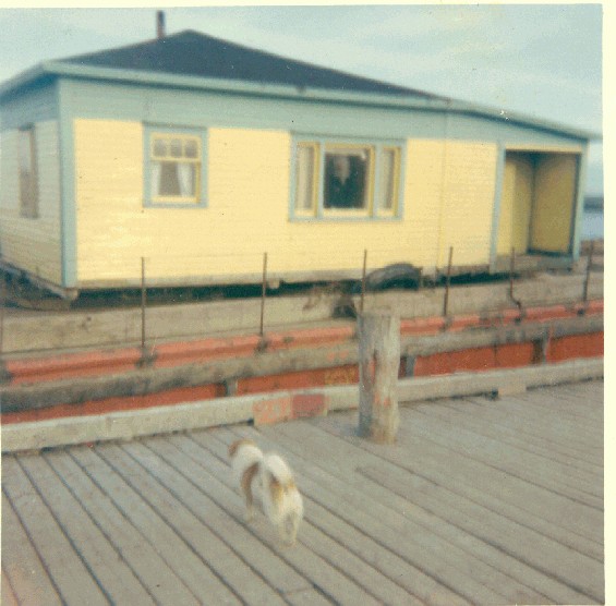 |
| Photo Title: | Stanley Keeping house, Garnish, on the barge that moved it from Point Rosie, Fortune Bay, Newfoundland |
| Image No.: | PF-317.461 |
| Image Location: | Resettlement/pf317_461.jpg |
| Date of Creation: | Digitized 2004 (originally created 1969) |
| Physical Description: | 1 digital photograph : col. |
| Biography/Admin History: | Originally named by the French as Point Enragée, this community, located on the Burin Peninsula 16 kilometres north of Garnish, was known to its English settlers as Point Rosie. However, early in the 20th century, the Newfoundland Government's Nomenclature Board officially renamed the community as Point Enragée, but everyone continued to use the old name. The residents were inshore fishers, relying on codfish and, to a greater degree in later years, lobster. The lack of topsoil made farming difficult but many people had livestock. Strong markets for lobster after Confederation kept the community relatively prosperous. However, by 1964 talk of resettlement convinced many that it was the only option for Point Rosie. In the 1920s the population stood at about 150 but by 1967 only eight families remained and two years later, all had left. The majority moved to Garish but others went to Grand Bank and English Harbour West. The Anglican Church was moved to Frenchman's Cove in 1973 after its church had been destroyed by fire. The images show life in Point Rosie prior to and during the period of resettlement. |
| Collector: | MHA |
| Source Donor: | Rowena Caines |
| Collection Title: | Resettlement Digital Photograph Collection |
| Associated Material: | Craig Leonard Photograph Collection, PF-328 |
| Restrictions on Access: | MHA has permission to copy images. Copyright is held by Rowena Caines. |
| Copyright: | c-mha |
| Physical Condition: | Good |
| Notes: | Title based on contents of image. |
| Subjects: | Dwellings--Newfoundland and Labrador--Garnish. |