Home  New Search
|
|
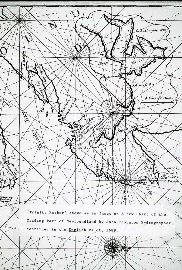
| Photo Title: | "Map of Trinity Harbour" |
| Description: | Map of Trinity Harbour, Trinity Bay, Newfoundland with the caption: "Trinity Harbor shown as an inset on a new chart of the trading part of Newfoundland by John Thorton Hydrographer, contained in the English Pilot, 1689." |
| Image No.: | PF-327.1286 |
| Image Location: | Handcock/pf327_1286.jpeg |
| Date of Creation: | [between 1973 and 1993] |
| Physical Description: | 1 slide : col. ; 35 mm |
| Collector: | Dr. Gordon Handcock |
| Source Donor: | Donated by Dr. Gordon Handcock, November 14, 2007 |
| Collection Title: | Dr. Gordon Handcock Slide Collection |
| Restrictions on Access: | Copyright held by the Maritime History Archive. No image from the fonds may be reproduced for research or publication without permission from the archivist. |
| Copyright: | c-mha |
| Physical Condition: | Excellent |
| Notes: | Title statement taken from content of slide. - Date of creation is based on the date of the creation of the slide. |
| Subjects: | Land use surveys--Newfoundland and Labradior--Trinity / Harbours / Statistical maps / Thornton, John, 1641-1708. |